Understanding Wildfire Behavior in Spain
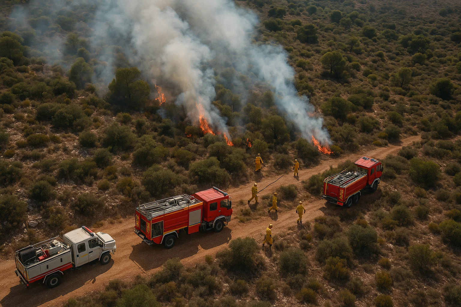
Every summer, Spain’s Mediterranean climate turns forests and grasslands into potential ignition zones. Long droughts, strong Levante winds, and dense fuel loads create conditions where a single spark can lead to large-scale destruction. Knowing how fire behaves how it starts, spreads, and changes is the backbone of wildfire safety and effective suppression.
This guide gives Spanish firefighters, civil-protection volunteers, and EMS responders a practical, step-by-step framework for predicting fire movement and operating safely under INFOCA and EU Civil Protection protocols.
Objective: equip responders with operational awareness of fuel, weather, and topography so they can anticipate behavior changes, make tactical decisions, and avoid entrapments.
Wildfire Behavior: Key Principles and Regional Context
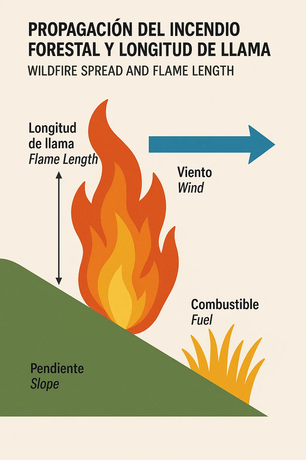
Wildfire behavior is the combination of three main factors fuel, weather, and topography.
Each interacts differently in Spain’s varied landscapes: from the pine-covered Sierras to the dry scrub of Andalucía.
1. Fuel
Fuel is any burnable vegetation grasses, shrubs, pine needles, or fallen bark.
Spain’s Mediterranean vegetation includes high-oil content plants like pines, rosemary, and eucalyptus, which release volatile gases that intensify flames.
Fuel Properties to Monitor
| Property | Description | Operational Concern |
|---|---|---|
| Moisture Content | Amount of water in vegetation | Low moisture = faster ignition |
| Fuel Size Class | Grass, brush, timber | Determines burn duration and heat output |
| Continuity | How connected fuels are horizontally and vertically | Continuous fuels allow rapid spread |
| Fuel Loading | Quantity of combustible material per area | Higher load increases intensity |
Pro Tip: In early summer, fine fuels (grasses) dominate. By mid-season, heavy fuels (shrubs, forest litter) drive large fires. Adjust tactics accordingly.
2. Weather
Spain’s weather variability especially dry westerlies (Poniente) and humid easterlies (Levante) dictates daily fire danger.
- Temperature: Higher temperatures lower fuel moisture.
- Relative Humidity (RH): Below 30 % drastically increases ignition potential.
- Wind: The most unpredictable and dangerous variable. Winds over 20 km/h can shift a flank fire into a fast-moving head fire within minutes.
- Atmospheric Stability: Inversions may trap smoke, while unstable air (cumulus build-up) can create erratic flame columns or fire whirls.
Pro Tip: Always cross-check local AEMET (Agencia Estatal de Meteorología) bulletins for wind-shift warnings before attack planning.
3. Topography
Spain’s hilly terrain especially in Catalonia, Valencia, and the Canary Islands accelerates fire movement uphill. Fire pre-heats fuels above it, making slope one of the most critical spread factors.
Slope Impact Rule of Thumb:
For every 10° increase in slope, fire speed roughly doubles.
Other features:
- Aspect: South-facing slopes dry out faster, promoting ignition.
- Barriers: Roads, rivers, and rock outcrops can serve as anchor points.
- Canyons and Ravines: Funnel winds, creating blow-torch effects known locally as chimeneas de fuego.
Step-by-Step Guide to Predicting and Managing Fire Behavior
Step 1: Conduct an Initial Size-Up
A proper size-up defines everything else.
Use the LACES model Lookouts, Awareness, Communication, Escape Routes, Safety Zones.
Checklist for Size-Up
- Identify fire origin and estimate rate of spread.
- Determine wind direction and speed (handheld anemometer).
- Evaluate fuels type, height, continuity.
- Note terrain slope and potential chimneys.
- Assess values at risk (homes, infrastructure, natural reserves).
- Establish anchor point and possible containment lines.
- Communicate findings to Incident Command.
Step 2: Classify the Fire Type
| Fire Type | Description | Example in Spain | Key Tactic |
|---|---|---|---|
| Surface Fire | Burns grasses, shrubs | Sierra Nevada grasslands | Direct attack with hand tools |
| Crown Fire | Moves through tree canopies | Pine forests of Castilla y León | Indirect attack, aerial drops |
| Ground Fire | Smolders in organic soil | Peat zones in Galicia | Dig trenches, use foam/water mix |
| Spot Fire | Ignitions from flying embers | WUI near Málaga | Patrol downwind areas aggressively |
Pro Tip: Embers can travel up to 2 km under strong winds don’t rely on single containment lines near towns.
Step 3: Apply the Fire Behavior Triangle
Think of fuel, weather, and topography as a triangle change one side, and fire behavior changes immediately.
- If humidity drops → rate of spread rises.
- If slope increases → flame length grows.
- If wind shifts → fire direction flips.
During operations, continuously update ICS 201 or 209 forms with these variables to brief teams accurately.
Step 4: Determine Rate of Spread and Flame Length
Use field indicators:
- Rate of Spread (ROS): Compare flame tip movement vs. reference object (e.g., tree or marker).
- Flame Length: Estimate in meters direct attack safe if ≤1.2 m; use indirect tactics above that.
| Flame Length | Fireline Intensity | Attack Method |
|---|---|---|
| 0–1 m | Low (<200 kW/m) | Hand tools, water backpacks |
| 1–2 m | Moderate | Hose lines, dozer lines |
| 2–4 m | High | Indirect attack, aerial support |
| >4 m | Extreme (>4,000 kW/m) | Defensive, retreat to safety zones |

Equipment and Tools for Wildfire Operations
Specifications & Selection
| Equipment | Specification | Operational Use |
|---|---|---|
| Backpack Pump | 18–20 L capacity, brass nozzle | Mop-up, small flare-ups |
| Drip Torch | 1.2 L mix (diesel/gas 3:1) | Controlled burn-outs |
| Pulaski Tool | Axe + hoe combo | Handline cutting |
| McLeod Rake | 8-inch tines | Clearing duff & debris |
| Fire Shelter | Aluminum-based reflective layer | Last-resort entrapment protection |
| Thermal Imaging Camera (TIC) | 160×120 px min resolution | Detect hotspots during overhaul |
Pro Tip: Spanish brigades often integrate INFOCA-approved backpack pumps (17–20 L) with anti-corrosion aluminum frames due to saline winds near coastal areas.
Inspection, Donning/Doffing, and Maintenance Cycles
- Before Deployment:
- Check seals, hoses, and torch caps for leaks.
- Inspect fire shelters for tears.
- Ensure radio frequencies match ICS channel plan.
- During Operations:
- Maintain 3–5 m spacing between operators.
- Rotate crews every 45 min in high-heat conditions (>32 °C).
- After Operations:
- Clean and dry tools to prevent corrosion.
- Recharge backpack pumps.
- Log equipment use in daily ICS 214 form.
Field Scenarios and Case Applications
Case 1: Wind-Driven Fire in Valencia (2024)
A rapid-spread grass-to-forest fire near Ayora caught crews in wind speeds exceeding 35 km/h. Flames outran suppression lines within 15 minutes.
Lessons Learned
- Initial anchor point not reinforced before wind shift.
- No secondary safety zone.
- Successful save due to lookout radioing wind change via INFOCA network.
Case 2: WUI Incident near Málaga
Embers crossed a highway and ignited rooftop vegetation in a housing estate. Volunteer brigades controlled structure fires using Type 1 engines and garden hydrants.
Takeaway: Urban–wildland interfaces require pre-incident defensible-space education trim vegetation, install Class A-rated roofing, clear 30 m zones.
Case 3: Pine Forest Fire, Castilla y León
Steep slopes caused flame lengths over 5 m. Crews switched to indirect attack using retardant lines and aerial drops from CL-415 aircraft.
Key Observation: Flame length prediction model accurately prevented crew exposure proof that training in behavior fundamentals saves lives.
Training and Safety Guidelines
Core Drills
- Fire Behavior Observation Drill
- Practice estimating flame lengths and spread using training fires.
- LACES Simulation
- Team establishes lookout and escape routes under timed exercise.
- Fuel Moisture Testing
- Weigh and oven-dry fuel samples to compute moisture %.
- Wind Shift Drill
- Simulated radio communication and repositioning.
ICS and Communication Protocols
Spain’s wildfire management follows the Incident Command System (ICS) integrated with INFOCA’s coordination centers.
- IC (Incident Commander): Defines objectives, safety priorities.
- Operations Section Chief: Directs suppression resources.
- Safety Officer: Conducts risk assessment using ICS 215A (Hazard Analysis).
- Communications Unit: Assigns radio channels (VHF/UHF).
Pro Tip: Always relay LUNAR reports (Location, Unit, Name, Assignment, Resources needed) during emergencies.
Personal Accountability and PAR Checks
Conduct PAR (Personnel Accountability Reports) every 30 minutes or after tactical shifts. Missing member? Initiate Rapid Intervention Crew (RIC) under command approval.
Pro Insights Box What Pros Actually Do
- Predict, don’t react: use weather apps and portable sensors to anticipate wind changes.
- Anchor early: secure initial attack from the safest lower point on slope.
- Stay mobile: keep packs light; mobility saves lives during flare-ups.
- Monitor RH: below 25 %, switch from offensive to defensive tactics.
- Practice radio brevity: clear, calm, concise especially in multilingual zones.
- Rest and hydrate: heat exhaustion lowers judgment faster than smoke exposure.
- Document behavior shifts: after-action reports help refine local training.
Frequently Asked Questions
What’s the most common cause of wildfire escalation in Spain?
Wind-driven spotting. Embers lifted by dry winds ignite new fires beyond the control line, especially in pine forests with resin-rich fuels.
How can responders predict dangerous wind shifts?
Monitor real-time AEMET updates, use handheld weather meters, and maintain visual contact with smoke columns tilting smoke often signals direction change.
What’s the safest distance for a safety zone?
A minimum of 4 × flame height in radius. Example: for 3 m flames, maintain 12 m clearance around personnel and apparatus.
How does Spain’s INFOCA integrate with EU mechanisms?
INFOCA coordinates regional operations while the EU Civil Protection Mechanism mobilizes cross-border air and ground resources during Level 2 incidents.
What new technologies aid wildfire behavior prediction (2023–2025)?
Thermal drones, satellite-based MODIS/VIIRS sensors, and mobile GIS mapping apps help teams track spread and temperature gradients in real time.

Alex Smith, a seasoned medical technician with 15 years in ambulance services, writes crucial first-aid tips and emergency care insights on arescuer.com.
